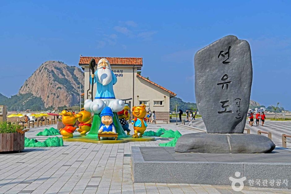
Seonyudo Island is the central island of the Gogunsan Islands in Okdo-myeon. Bridges link it to Munyeodo Island, Jangjado Island, and Daejangdo Island, so you can walk between them, and it has Myeongsasimni Beach, Mangjubong Peak, and tidal flats that appear at low tide. A naval base stood here in the Joseon period, and Admiral Yi Sunsin stayed on the island after the Battle of Myeongnyang in 1597.
Hours
Open all day
Closed days
Open all year
Fees
Not listed
Parking
Seonyu 2-gu parking lot (331 spaces); 11 large…more ↓
Needs checking: Fees
Sources: Gunsan City Culture and Tourism·Korea Tourism Organization TourAPI·Korea Tourism Organization barrier-free travel information (TourAPI)
Shown for seaside places only, when the nearest tide station is within 30 km in a straight line. The curve joins the times and heights of high and low tide.
Sunset
17:27
Sunrise 07:11
Sources: Hours and closed days: Korea Tourism Organization · Sunrise and sunset: calculated from the place's coordinates · Tides: Korea Hydrographic and Oceanographic Agency
Seonyudo Island before you go
Hours
Open all day — source 1
Closed days
Open all year — source 1
Parking
Seonyu 2-gu parking lot (331 spaces); 11 large buses can park — source 2
Contact
063-454-7280 Original — source 1
Address
전북특별자치도 군산시 옥도면 선유남길 34-22 Original — source 1
Not listed Fees
1Korea Tourism Organization TourAPI
2Gunsan City Culture and Tourism
3Korea Tourism Organization barrier-free travel information (TourAPI)
Seonyudo Island photos 6
Seonyudo Island2/6Source: Korea Tourism Organization · KOGL Type 3 (no changes allowed)
Seonyudo Island3/6Source: Korea Tourism Organization · KOGL Type 3 (no changes allowed)
Seonyudo Island4/6Source: Korea Tourism Organization · KOGL Type 3 (no changes allowed)
Seonyudo Island5/6Source: Korea Tourism Organization · KOGL Type 3 (no changes allowed)
Seonyudo Island6/6Source: Korea Tourism Organization · KOGL Type 3 (no changes allowed)
Source: Korea Tourism Organization · KOGL Type 3 (no changes allowed)
Seonyudo Island more information
Credit card payment
None — source 1
Activities
[Zipline (Seonyu Sky Sunline)] - Hours: weekdays 09:30–17:30 / weekends 09:30–17:40 - Fees: ages 14 and up 20,000 won / ages 13 and under 16,000 won ※ Prices are for 1 ride ※ Inquiries and information: 0507-1359-8602 — source 1
Website
https://www.gunsan.go.kr/tour/m2201 Original — source 1
Where the name Seonyudo Island, its old name Gunsando and 'Gogunsan' come from
Seonyudo Island was originally called Gunsando. It got its current name because the top of a peak about 100 m high at the island's north end looks like two Taoist immortals sitting face to face and playing Go. When Gunchang, the gateway to the Honam granary region, was renamed Gunsan, the character go (古, old) was added to this island group's name, creating the name Gogunsan. Seonyudo Island covers 2.13 km² and has more than 500 residents. It is the third-largest island in the Gogunsan Islands.
Seonyudo Island was a Joseon naval base, and its naval commander governed 8 counties
In the Joseon period, Seonyudo Island was the headquarters and base of the navy, and at times a naval commander controlled the island. While the Jeolla naval headquarters was in place, the naval commander governed 8 counties: Impi, Gunchang, Mangyeong, Gimje, Buan, Mujang, Gochang and Yeonggwang. In the Goryeo period it was a port of call on the trade sea route between Goryeo and Song China. On the island, a shell mound and a group of stone monuments to the good rule of naval commanders remain.
Admiral Yi Sunsin stayed on Seonyudo Island after the 1597 Battle of Myeongnyang
Admiral Yi Sunsin anchored at Seonyudo Island on September 21, 1597 (the 30th year of King Seonjo), 6 days after the Battle of Myeongnyang. In that battle, he sank 31 of 133 enemy ships. But he had only 12 ships, so he moved north to avoid pursuit and came to this island by way of Wido Island. His war diary, Nanjung Ilgi, records that he fell badly ill with a fever on Seonyudo Island and that autumn typhoons made it hard to move the ships. He died in the Battle of Noryang on November 19, 1598, at age 54, 14 months after leaving Seonyudo Island.
Seonyudo Island, home to 5 of the 8 Views of Gogunsan, and Seonyubong Peak at 150 m above sea level
The 8 Views of Gogunsan are Seonyu Sunset, Returning Sails of the Three Islands, Wild Geese Landing on Flat Sand, Mangjubong Peak and Myeongsasimni Beach. The others are Fishing Fires of Jangja, Woryeongdae of Sinsido and the 12 Peaks of Musan. 5 of them are on Seonyudo Island. Mangjubong Peak is two towering rock peaks. Its name comes from a legend of an exiled official who missed the king and climbed it every day to look toward Hanyang. Seonyu Sunset refers to the sun setting toward Maldo Island on summer afternoons. From Seonyubong Peak, the island's highest point at 150 m above sea level, you can see Bangchukdo Island, Myeongdo Island and Maldo Island side by side.
Videos·Articles from abroad·Blog posts
차 없이 떠나도 대만족! 선유도 스카이워크부터 갑오징어 중식까지 군산 싹 쓸어옴ㅣ테마기행 길 260731 방송
Yes. The Seonyu 2-gu parking lot holds 331 cars, and up to 11 large buses can park.
How do you tour Munyeodo Island, Jangjado Island, and Daejangdo Island from Seonyudo Island?
The four islands are linked by bridges, so you can go around on foot or by bicycle. By bicycle, a loop of Seonyudo Island plus a round trip to Jangjado Island and Daejangdo Island takes 1 hour, and a round trip to Munyeodo Island takes 1 hour. Even with sightseeing, you can see all four islands in 3 hours.
Is the water deep at Seonyudo Island's Myeongsasimni Beach?
Even far out, the water is only about 2 m deep. The sandy beach is 200 m wide, and despite the 'simni' (ten ri) in its name, it is about 1.5 km long.
What can you catch on the Seonyudo Island tidal flats?
At low tide you can dig for razor clams, Manila clams and hard clams, or catch turban shells, fiddler crabs and ghost crabs. For razor clams, sprinkle a little salt in the hole and catch the clam when it pokes its head out. Shore catches are most plentiful on the tidal flats near both ends of the beach.
Did Admiral Yi Sunsin stay on Seonyudo Island?
Yes. After winning the Battle of Myeongnyang in 1597, Admiral Yi Sunsin reached Seonyudo Island on September 21, 6 days after the battle, and stayed to regroup his forces.
How did Seonyudo Island get its name?
The top of a peak about 100 m high in the north of the island looks like two Taoist immortals facing each other and playing Go, which gave the island its name. Before that, it was called Gunsando.
What is the highest peak on Seonyudo Island?
Seonyubong Peak, 150 m above sea level, is the highest peak on Seonyudo Island. From the top, you can take in the surrounding scenery at a glance and see Bangchukdo Island, Myeongdo Island, and Maldo Island standing side by side.
How did Seonyudo Island's Myeongsasimni Beach form?
It is a shore that formed over a long time as sand carried by the waves piled up into a dune between the three islands that once made up Seonyudo Island. This dune joined Seonyudo Island into one island, as it is today.




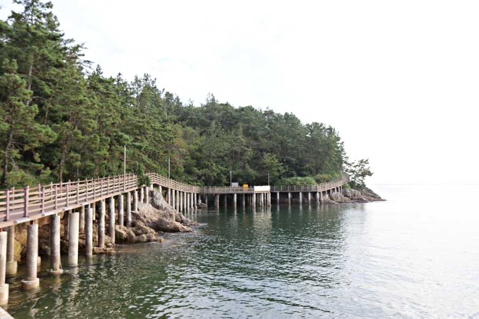 Seonyudo Trailstraight-line 248m
 Seonyu Bridgestraight-line 327m
 Gunsan Seonyudo Cruisestraight-line 374m


 Namdo Bapsangstraight-line 333m
 Cafe La Pharestraight-line 1.4km
 Seonyudo Bambadastraight-line 1.7km